We sell instore the following HEMA Maps, Atlas and Guides, Regional Maps, Camp Oven Cook Books:
With over 30 years of expertise in exploring Australia, Hema Maps has developed a range of guide books and regional atlases designed to help you prepare to explore. Our range includes the iconic series of products including Cape York Atlas & Guide, Great Desert Tracks, 4WD Adventures and our all new Where to Camp guide.
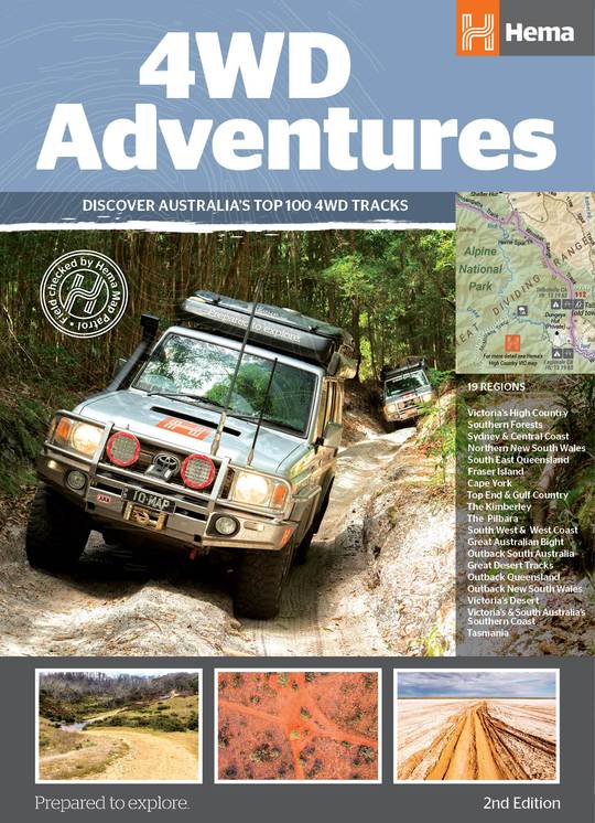
4WD Adventures (2nd Edition)
Discover Australia’s Top 100 4WD tracks using this guide as your ultimate off-road adventure tool. Each page features colourful, glossy imagery and detailed tracks personally mapped out and driven by the Hema Map Patrol and our team of experts, for the most up-to-date information across 19 different regions of Australia. With the 4WD Adventures guide, you can expect to have a reliable source of knowledge at your fingertips, turning your 4WD trip into a reality.
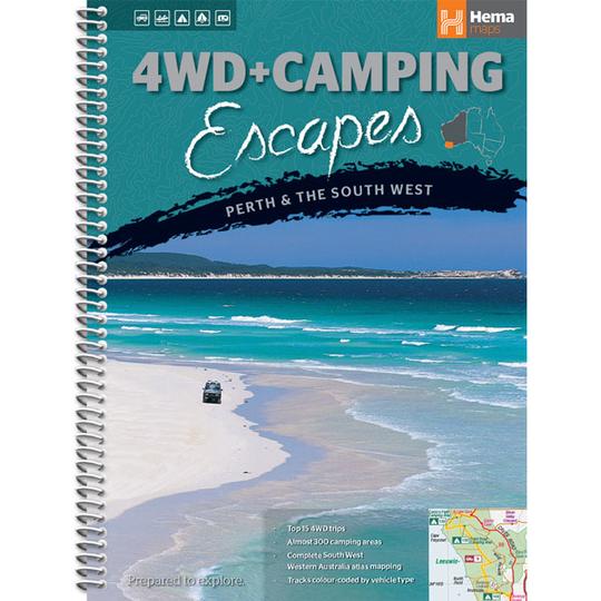
4WD + Camping Escapes Perth and the South West (1st Edition)
This guide from Hema outlines the best four-wheel driving and camping locations in the picturesque South West Western Australia.
Each regional section outlines the area’s 4WD Tracks and a camping directory at the end to provide comprehensive coverage of the regions camping areas.
The complete atlas contains Hema’s South West Western Australia map, featuring 24hr fuel, information centres, rest areas and points of interest.
The guide features 15 4WD tracks, each with its own detailed inset map showing the route taken. The range of trips includes some suitable for first-timers as well as others for the more experienced looking for something new to tackle. All of the tracks are colour-coded to make it simple to find the tracks that suit your type of vehicle and handy symbols show towing suitability too.
The featured camping area descriptions help you find a site to suit your requirements, whether you want a 2WD-accessible spot with toilets and a shower that’s suitable for your caravan, or a 4WD-only bush camp with no facilities but where your pet is allowed. The book is written by Michael and Jane Pelusey, who are both keen outdoor enthusiasts and experienced travel writers. There’s also plenty of essential pre-trip reading on terrain, permits, environmental issues, fishing and bushwalking.
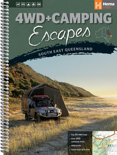
4WD + Camping Escapes South East Queensland (1st Edition)
This guide from Hema outlines the best four-wheel driving and camping locations in the picturesque South East Queensland featuring: Brisbane & Moreton Bay Islands, Sunshine Coast, Hinterland & South Burnett, Cooloola Coast, Main Range & South West
Each regional section outlines the area’s 4WD Tracks and a camping directory at the end to provide comprehensive coverage of the regions camping areas.
The complete atlas contains Hema’s South East Queensland map, featuring 24hr fuel, information centres, rest areas and points of interest.
This guide features 20 4WD tracks, each with its own detailed inset map showing the route taken. The range of trips includes some suitable for first-timers as well as others for the more experienced looking for something new to tackle. All of the tracks are colour-coded to make it simple to find the tracks that suit your type of vehicle and handy symbols show towing suitability too.
The featured camping area descriptions help you find a site to suit your requirements, whether you want a 2WD-accessible spot with toilets and a shower that’s suitable for your caravan, or a 4WD-only bush camp with no facilities but where your pet is allowed.
The book is written by Michael and Jane Pelusey, who are both keen outdoor enthusiasts and experienced travel writers.
There’s also plenty of essential pre-trip reading on terrain, permits, environmental issues, fishing and bushwalking.
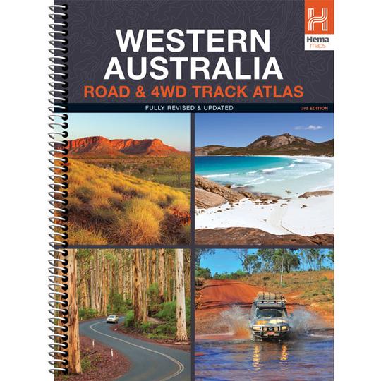
Western Australia Road & 4WD Track Atlas (3rd Edition)
Discover Australia’s largest state with the Western Australia Road & 4WD Track Atlas. Plan and navigate your trip with state-wide atlas mapping, which includes detailed coverage of Perth and Southwest Western Australia (WA). Find an adventure with a list of the state’s Top 50 4WD Trips, which each have a track grading, distances, contact information and an atlas reference. There’s even detailed information on Western Australia’s Top 25 National Parks, including camping areas within each park, things to do, contact details, an inset map and a rundown of what makes each park unique. To top it off, there is also a list of private camping areas and caravan parks, an index and a list of all accredited visitor centres within Western Australia.
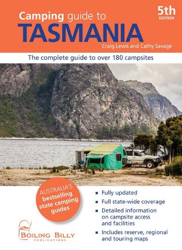
Camping Guide to Tasmania (5th Edition)
The perfect guidebook to over 180 sites throughout Tasmania in more than 50 parks, forests and reserves. The newest edition contains 5 regional and 12 park and reserve maps.
Over 180 campsites, Full state-wide coverage, Detailed information on campsite access and facilities, Includes reserve, regional and touring maps
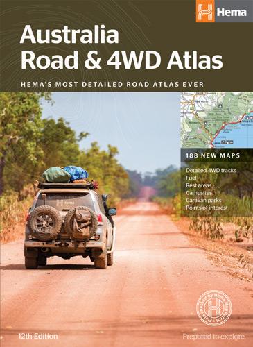
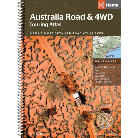
Australia Road & 4WD Touring Atlas – 215 x 297mm (12th Edition)
Featuring trusted Hema mapping for all of Australia, the Hema Road & 4WD Touring Atlas is the definitive travel guide for tourers and adventurers. Hema atlases feature more information useful to travellers, including 4WD tracks, campsites, caravan parks, rest areas, 24-hour fuel and points of interest.
This edition contains more mapping than ever before, which is enhanced by a striking new cartographic style that?s incredibly easy to read. Included in this is up-to-date mapping for Australia’s biggest 4WD destinations: Cape York, Fraser Island, the Top End, the Kimberley, the Pilbara, Central Australia, High Country Victoria and the Flinders Ranges.
A handy distance grid, national park guide, list of accredited information centres and a complete index are also included to assist with trip planning and navigation, making it the perfect tool for guiding tourers, campers, road trippers and off-roaders throughout Australia.
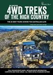
4WD Treks of the High Country (1st Edition)
4WD Treks of the High Country leads readers through twenty-six of the best four-wheel drive touring destinations in both the Victorian and New South Wales alpine region. Jam-packed full of information on the region’s history, natural features and highlights, this detailed guide makes an indispensable travelling companion for those setting out to explore one of the country’s most unique areas. The guide features over 150 stunning full colour photographs which help bring the High Country to life.
Whilst exploring this awe-inspiring region, travellers will discover old gold mining towns tucked away in secluded valleys, marvel at breathtaking vistas from atop some of the region’s highest peaks and be guided to great campsites to throw down their swags, often beside babbling mountain streams. With the aid of comprehensive route directions, intrepid adventurers are guided on the right track from start to finish, taking in many little-known points of interest tucked away in the mountains.
As one of Australia’s premier four-wheel drive touring destinations, 4WD Treks of the High Country will help readers get the best from their adventure to this stunning area.
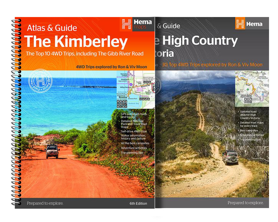
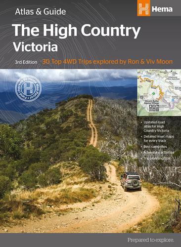
The Victorian High Country Atlas & Guide (3rd Edition)
The definitive guidebook for discovering the Victorian High Country, featuring the Top 30 4WD Trips written by Ron and Viv Moon, in combination with topographic atlas mapping for the region.
This edition of Hema’s best-selling outdoor guidebook for discovering the Victorian High Country now features 40 atlas pages at a large scale of 1:150 000 in a stunning new cartographic style. The guide now features the Top 30 4WD Trips for the High Country, which has been written by off-road legends Ron and Viv Moon. Also included is an introduction to the region, as well as information sections on planning the trip and what to see and do. There are detailed touring sections on the distinct regions of the High Country, including the Great Alpine Road, Alpine National Park as well as Snowy River and Baw Baw national parks. The Top 30 4WD Trips are broken into their respective localities, with each trip containing comprehensive trip information including gradings, distances, relevant travel information and drive coverage from start to finish.
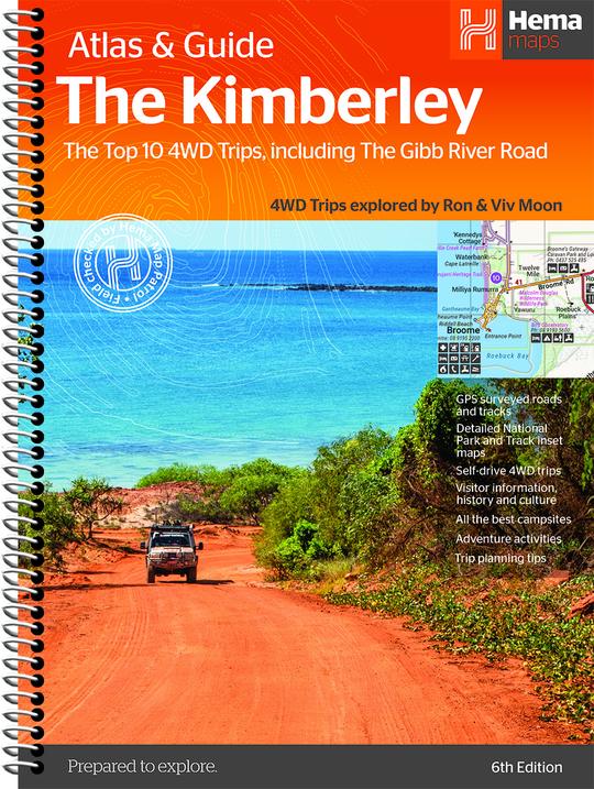
Kimberley Atlas & Guide (6th Edition)
The definitive guidebook for exploring Western Australia’s Kimberley region, featuring the Top 10 4WD Trips written by Ron and Viv Moon, in combination with topographic atlas mapping for the region.
This edition of Hema’s best-selling outdoor guidebook for discovering the Kimberley now features 20 atlas pages in a stunning new cartographic style. The guide now features the Top 10 4WD Trips for the Kimberley, which has been written by off-road legends Ron and Viv Moon. Also included is an introduction to the region, as well as information sections on planning the trip and what to see and do. There are detailed touring sections on the distinct regions of the Kimberley. The Top 10 4WD Trips are broken into their respective localities, with each trip containing comprehensive trip information including gradings, distances, relevant travel information and drive coverage from start to finish.
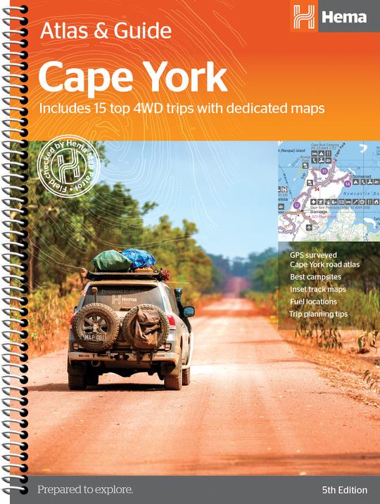
Cape York Atlas & Guide (5th Edition)
Hema Maps’ Cape York Atlas & Guide helps you make the most of your visit to this remarkable part of Australia.
With detailed coverage of The Tip, the coast from Cairns to Cooktown, Rinyirru (Lakefield) National Park, the Peninsula Developmental Road, Old Telegraph Track, Torres Strait and the Savannah Way, it ensures you won’t miss the ‘must-see’ attractions, but it also describes some of the lesser known areas favoured by the experts. Whether you just want to make it to The Tip or are looking for a serious 4WD adventure, this informative book is an indispensable companion.
The book features 15 4WD trips, explored and revised by travel journalist Ian Glover, with photography by Matt Williams. Each trip has a detailed map, plus all the information you need to plan the trip including trip grading, longest distance without fuel, permits and contact details.
This brand new edition of Hema’s best-selling outdoor guidebook for discovering Cape York now features 22 atlas pages in a stunning new cartographic style and also incorporates content from the popular Cape York Travel & Adventure Guide by Ron and Viv Moon as well.
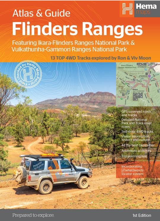
Flinders Ranges Atlas & Guide (1st Edition)
This first edition of Hema’s Flinders Ranges Atlas & Guide features Hema’s distinctive and informative maps, all of which have been field checked by Hema’s Map Patrol to ensure the best possible accuracy with the latest mapping data.
Written and researched by some of the most experienced outback travellers in Australia (including industry doyen, Ron Moon), the guide provides extensive and up-to-date information for the whole of the Flinders Ranges, from its southernmost tip, where it brushes against the waters of the Spencer Gulf, to its northern extremity beyond Arkaroola and the rugged Gammon massif.
Extensive cultural information and stories, along with the low-down on the European exploration and development of the region will ensure that today’s travellers see the country in a new, exciting and enlightened manner.
Comprehensive details to towns, national parks and each and every station property (open to the public) for hiking, cycling, camping, accommodation and four-wheel driving ensures you will have all the information you require for an enjoyable, interesting and exciting foray to these spectacular ranges.
The book includes 13 of Hema’s favourite 4WD tracks in the region that stretch from the rolling southern ranges to the much more remote and rugged northern extremities of the mountain vastness.
Lavishly illustrated with magical photographs recorded by the Hema team, this guide will inspire and motivate travellers to visit the region, whether for the first time or for the twentieth time.
This easy to use guidebook will take the difficulty out of planning a trip to this magnificent area and there is no better time to start planning that trip than now.
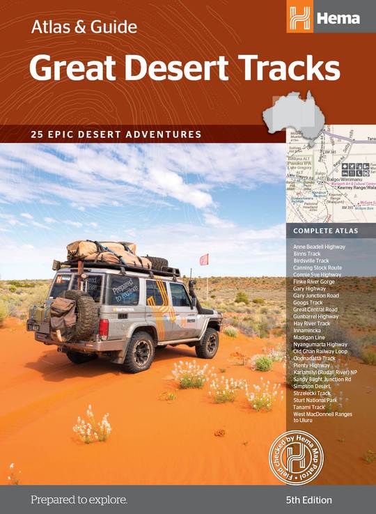
Great Desert Tracks Atlas and Guide (5th Edition)
For over 20 years, Hema’s Map Patrol has been mapping the interior of Australia. In this comprehensive guide to traversing Australia’s desert regions, Hema takes you into the arid heart of Australia. Whether you are a desert lover, or just looking to tackle some of Australia’s favourite 4WD destinations, this informative guide is an indispensable companion to those tackling Australia’s great desert tracks. This edition includes handy track profiles showing elevations and distances as well as points of interest, camping areas and supply points in one easy-to-follow graphic. There’s also plenty of essential pre-trip reading on how to prepare for your trek, safety in the outback and driving techniques, making this the must-have guidebook for travelling Australia’s deserts.
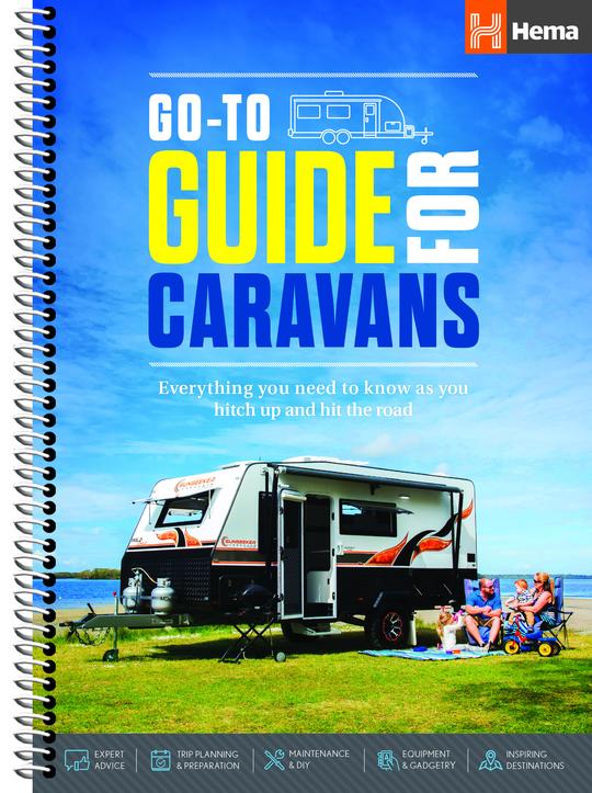
Go-To Guide for Caravans (1st Edition)
Hema’s Go-To-Guide for Caravans was the first release in Hema’s ‘Go-To’ series which contains Go-To guides for Motorhomes, Campers, 4WDs and Boats. This guide was produced in collaboration with Australia’s longest-running and industry-leading magazine Caravan World.
This publication is an informative introductory guide for those who plan on using a Caravan to travel around Australia. It covers a range of topics including; Trip Planning, Preparation, Equipment & Gadgetry, Maintenance & DIY, Safety & Security, Food & Frivolities, Inspiring Destinations
Hema’s Go-To-Guide for Caravans has been produced by industry experts, is presented in a clear and easy to understand format and of course provides a selection of Hema’s award-winning maps.
From windswept grey nomads to sun-kissed newly-weds, Hema’s Go-To Guide for Caravans is a vital companion for every kind of caravanning enthusiast.
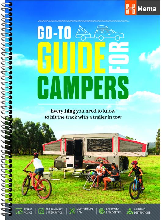
Go-To Guide for Campers (1st Edition)
Camper trailer touring is one of the most liberating ways to travel, allowing adventurous souls to push into some of Australia’s most remote and picturesque locations.
Hema’s Go-To-Guide for Campers was the second release in Hema’s ‘Go-To’ series which contains Go-To guides for Motorhomes, Caravans, 4WDs and Boats. This guide was produced in collaboration with the industry-leading magazine Camper Australia.
This publication is an informative introductory guide for those who plan on using a Camper Trailer or rooftop tent to travel around Australia. It covers a range of topics including; Trip Planning, Preparation, Equipment & Gadgetry, Maintenance & DIY, Safety & Security, Food & Frivolities, Inspiring Destinations
Hema’s Go-To-Guide for Campers has been produced by industry experts, is presented in a clear and easy to understand format and of course provides a selection of Hema’s award winning maps.
From windswept grey nomads to sun-kissed newly-weds, Hema’s Go-To Guide for Campers is a vital companion for every kind of camping enthusiast.
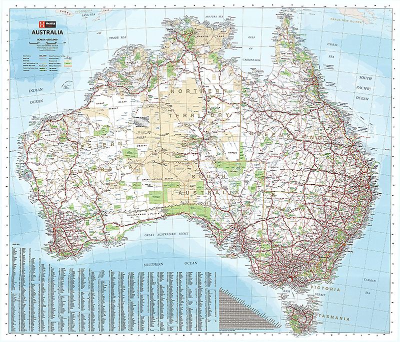
Large Wall Map of Australia. Best Scale 1:4500000. Size 875x1000mm.
A laminated map of Australia that is ideal as a reference and trip planning tool, with the country’s major road networks featured along with Outback fuel, distances and major national parks marked on the map. Comes packaged in a tube.
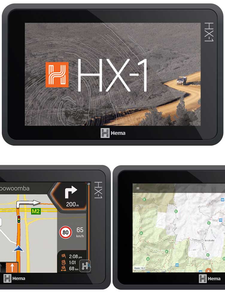
Hema HX-1 Navigator – Street & Explore
The Hema HX-1 Navigator just got even better! All units now come preloaded with Camps 9 & a brand new version of the Explorer Map (our most detailed yet), including new topographic mapping & an up-to-date track database thanks to the Map Patrol expeditions. In addition to this, all units come with new street mapping, user interface updates & new Hema-verified POI. Previously registered units can also be updated.